If you travel far enough to the east or west, chances are you’re going to go into a new time zone. There’s a funny thing about time zones though – you’d think they would be straight lines, but they’re not.
In the U.S. and Canada, for example, time zones are spread out so far that, depending on where you are, you could be in one city that’s on one time zone, and move directly north or south to another city and be in a whole different time zone.
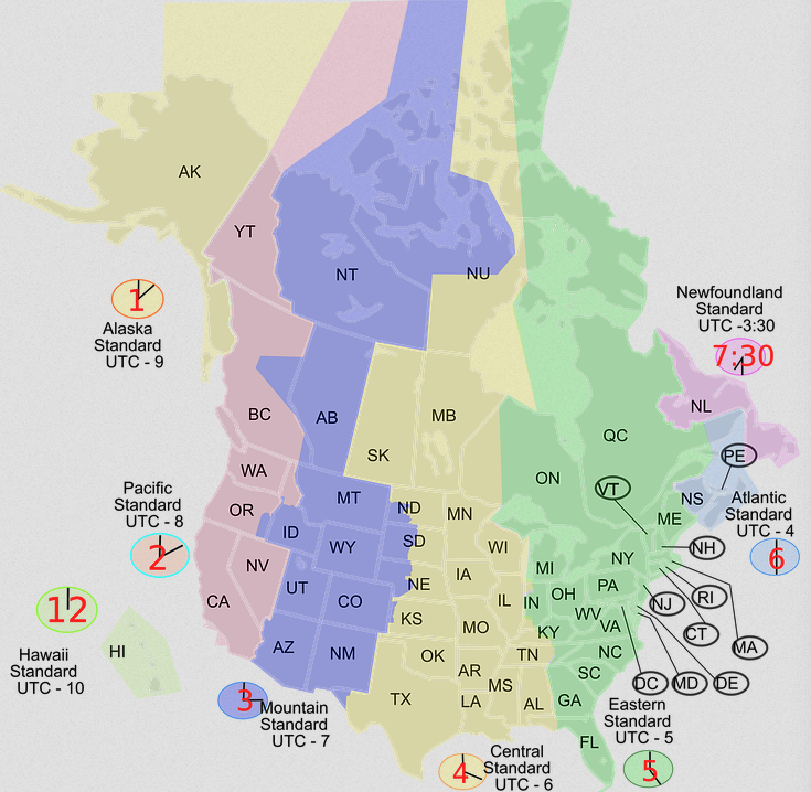
Case in point, you could be on Route 18 in far SW New Mexico and be in Mountain time. But if you take that road all the way into Texas, you’re then in Central Time.
What’s up with that?
Why do we have time zones?
Time zones weren’t organized and agreed upon until the late 1800s. Before then, as a way to have their own measure of time, some places had established their own time zones. For example, the sun would be at its highest peak and the head of the town would say, “That’s noon.” And they’d figure out time from that. Seriously, that’s how it was, way back when. But that meant places just a few dozen miles apart would each have their own time zone, based on when the sun was at its peak over THEIR town.
Anyway, as the world became more connected via train and ship, the whole “time zone” thing became more complicated; it was hard to make a train schedule with, for example, 70-something time zones across the US. So in the late 1800s, a bunch of scientists came up with an “official” system for time zones. They called it “standard time.”
How they did it
You probably learned this in school forever ago. But as a brief refresher, as the earth rotates on its axis, it moves roughly 15 degrees every 60 minutes. After 24 hours, it’s completed a full rotation of 360 degrees. The scientists used this information to divide the planet into 24 sections or time zones. Each time zone, which is an imaginary line, is 15 degrees of longitude wide. Except, as we said, it doesn’t really work that way. We’ll get into that in a second.
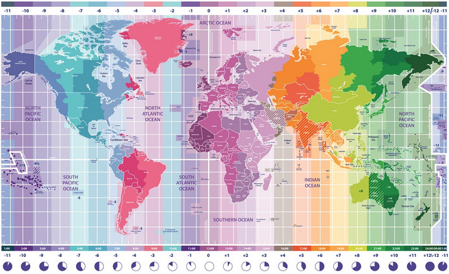
Greenwich Mean Time
The imaginary dividing lines begin at Greenwich, which is a suburb of London. The time at Greenwich is called Greenwich Mean Time (GMT). As you move west from Greenwich, every 15-degree section (read: time zone) is an hour earlier than GMT, while each time zone to the east is an hour later.
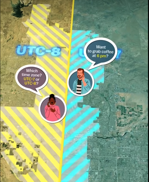
But if time zones are supposed to be straight imaginary lines, why are the lines so crooked in real life?
Because people prefer to do what’s most convenient for them. 😉
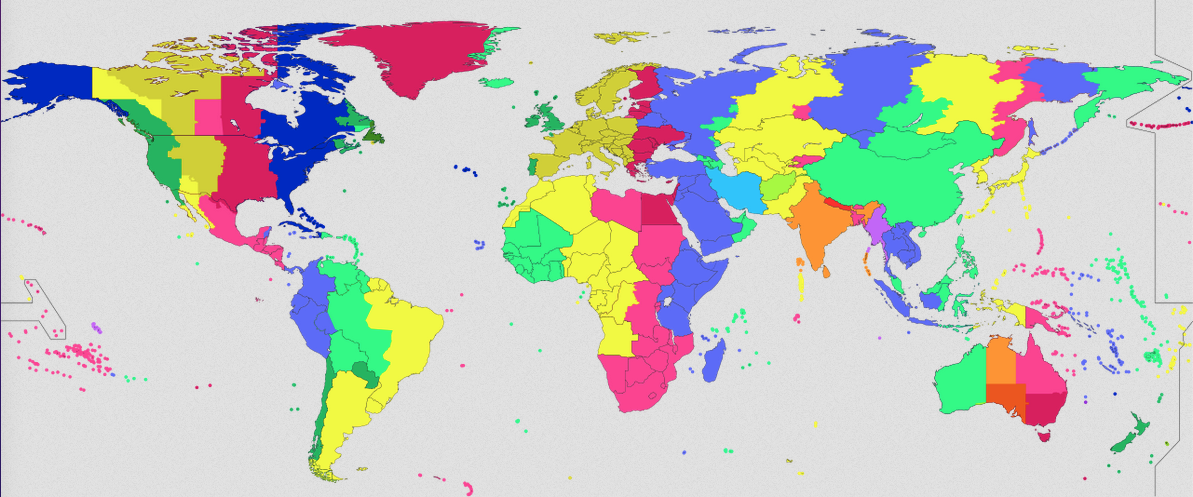
Essentially, each region considers geographical factors and sometimes simply the preferences of those in charge, when they decide their respective time zone(s). If a country, state, city, town, etc. is on the border of a time zone, they often want to keep their geography on the same time zone.
So, for example, China is technically located in 5 time zones, but chooses to only use one.


India also chooses to only use one singular time zone.
Similarly, if time zones were straight, many towns would be split, with part of them in one time zone and one in another. Phoenix, for example, thought that would be too inconvenient and confusing to be in 2 time zones, so the founding fathers all agreed that Phoenix would be in Mountain Time.
On the other hand, other towns are absolutely OK with having 2 time zones (but Phoenix’s solution tends to happen more often).
The outliers
As we said earlier, most time zones are separated by 1 hour differences. There are a handful of outliers, though. In Canada, Newfoundland Island, including the province capital St. John’s, observe Newfoundland Standard Time (NST) during standard time and Newfoundland Daylight Time (NDT) during Daylight Saving Time (DST). Those times are 30 minutes ahead of Atlantic time. Here’s why/how that is.
Similarly, Tehran, Iran and Kabul, Afghanistan are located 3.5 and 4.5 hours, respectively, east of UTC. And Nepal’s capital of Kathmandu is located near 5 hours and 45 minutes of solar time east of UTC, so Nepal chose that time for its time zone.
What about Daylight Savings Time (DST)?
That’s its own agenda. We’ll save that for another post.
Want to comment on this post? Great! Read this first to help ensure it gets approved.
Want to sponsor a post, write something for Your Mileage May Vary, or put ads on our site? Click here for more info.
Like this post? Please share it! We have plenty more just like it and would love it if you decided to hang around and sign up to get emailed notifications of when we post.
Whether you’ve read our articles before or this is the first time you’re stopping by, we’re really glad you’re here and hope you come back to visit again!
This post first appeared on Your Mileage May Vary

2 comments
Places that are not in synch with the hour are really crazy. India would be better off at GMT+6 rather than 5:30. Newfoundland and Labrador is another such crazy place.
Comment redacted by YMMV to remove portion(s) that is/are against YMMV’s requirements for approval
I remember listening to Canadian radio station CKLW in the 1970s. Ontario observed Daylight Saving Time, Michigan stayed on Standard time. The station would always say “9 o’clock at the Big 8, 8 o’clock in Detroit,” or “4:17 CKLW Daylight Time.”